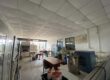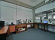

The GIS and Mapping Laboratory utilizes institutional research objectives to analyze and visualize gem-related spatial data.
Two High-performance Desktops and GIS Software

- GIS Software Operation
- Product information of GIS software — ArcGIS Pro 3.4.3
- Advanced spatial analysis, image processing, and 3D visualization
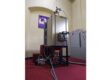
High-performance large-format inkjet printer

- Canon imagePROGRAF TM-3500
- Large-Format Printing (36-inch / A0)
- Plotting field survey maps, model analysis results, and Gem potential maps
Light Table

Manual map interpretation and digitization.
Stereoscope

- To 3D image analysis, especially in interpreting aerial photographs and satellite stereo pairs
- Helps visualize the third dimension (elevation or depth), critical for terrain and geological studies
Map Repository

1. Storage of Physical Maps
Large-format map sheets - Geology & Topographic maps in Sri Lanka (Scales: 1:100,000, 1:50,000, 1:10,000)
2. Digital Database
Stores vector data (shapefiles or feature classes) and raster data (satellite imagery, DEMs, scanned maps). Supports multiple formats: Shapefile, GeoTIFF, KML, File Geodatabase (GDB).